
Park Overview Map
Use this park map first, then compare scenic conditions below on the trail camera panel. Roads, major trails, parking, visitor services, and scenic districts are shown together on one main planning page.
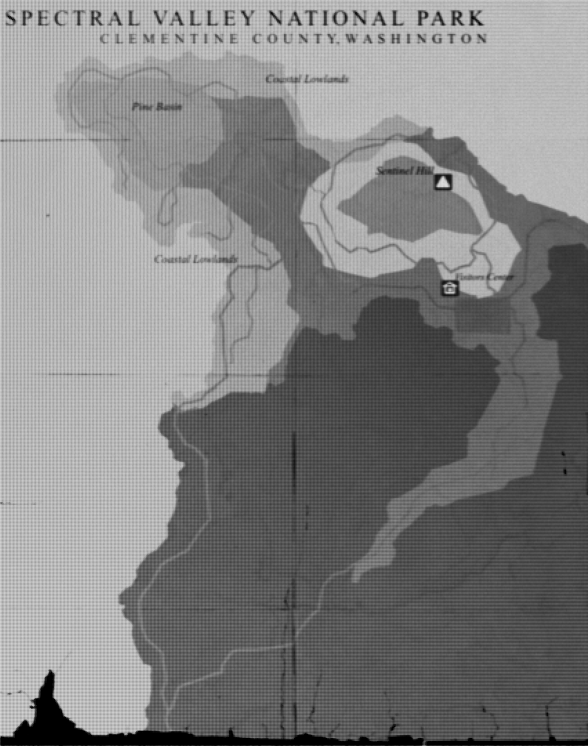
Map Key
- Main park road
- Trail
- Coastal Lowlands
- Pine Basin
- Sentinel Hill
- Parking or visitor service
Visitor Planning Note
Unpaved roads, streams, and temporary study closures are not shown on this draft. Check posted signs at the visitor center before entering backcountry trails.


The trail camera panel gives visitors a quick look at overlooks, wetland edges, weather, and seasonal conditions across the park.
Use the cameras to compare visibility, trail conditions, and likely wildlife-viewing times before choosing an overlook, roadside stop, or valley walk.
CHECK CONDITIONS BEFORE YOU GO
Park Overview Map
Trails & Scenic Areas
Park Activities & Experiences
Visitor Help & Contact

Explore overlooks, boardwalk routes, shoreline approaches, and visitor-favorite scenic areas across the park.

Browse ranger programs, wildlife-viewing areas, short walks, quiet shoreline stops, and evening observation options across the park.